Weather literacy for everyday life
Forecasts are easier to use when you understand the systems behind them. A plain-language guide.
Kiwi News Desk··4 min read
Forecasts are easier to use when you understand the systems behind them. A plain-language guide.

Clouds rolling over a coastal landscape
New Zealand sits in the path of weather systems that have travelled a long way over open ocean. That gives our forecasts a particular character: confident a day or two out, more uncertain beyond, and prone to sharp local variation when fronts meet the country's mountains.
Understanding a few basics — what a front is, why westerlies behave the way they do, how rainfall totals differ from rainfall intensity — makes any forecast more useful. It also makes it easier to plan around the times when the forecast itself is less certain.
Weather literacy matters for more than weekend plans. Farmers, builders, event organisers, emergency services and households all make better decisions when they can read a forecast in context rather than as a single icon.
Our weather coverage will lean toward explanation: not just what is coming, but why, and how confident anyone can reasonably be about it.
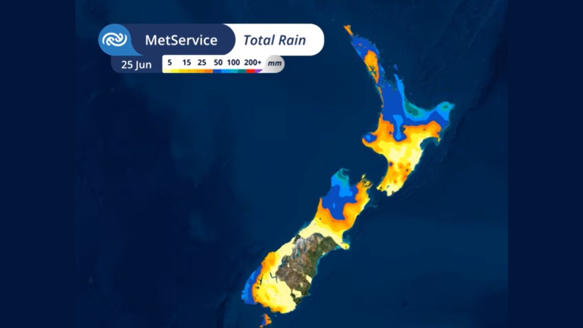
A low-pressure system arriving late Tuesday is forecast to bring up to 200mm of rain, severe gales and a sharp temperature drop across much of the country.