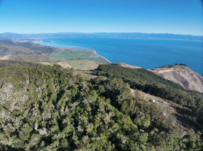
Nelson Tasman has moved a step closer to better severe-weather monitoring, with the Government confirming a site for the region's new weather radar near Drumduan's Horoirangi Peak.
The radar is planned about 15 kilometres northeast of Nelson City and roughly 630 metres above sea level. Ministers say the position will help monitor weather across a region that has relied heavily on the Wellington radar, which cannot adequately cover parts of northwest Tasman.
That matters because Nelson Tasman has lived through repeated high-impact weather events. The Government says the region has experienced five states of emergency since 2011, including severe July 2025 weather events that helped fast-track the radar commitment.
The project is funded at up to $5 million, with commissioning expected to cost between $3.5 million and $5 million and ongoing annual operating costs of about $260,000. MetService is expected to install and operate the radar, and ministers say it remains on track to be operational by mid-2027.
The technical detail is important. The radar will use modern Doppler dual-polarisation technology, which can provide more accurate rainfall estimates and enhanced weather monitoring. For emergency managers, councils, first responders and households, better short-term forecasting can change the timing and quality of decisions before a flood or severe-weather event lands.
Weather infrastructure rarely attracts attention until it is missing. A radar does not stop rain, slips or river rises. What it can do is improve the information available when agencies are deciding whether to close roads, monitor catchments, warn communities or prepare emergency responses.
For families, growers, tourism operators and rural communities, the practical value is earlier and more localised awareness. A better picture of rainfall over northwest Tasman could help people decide whether to travel, protect stock, delay work, move vehicles, check neighbours or prepare properties before conditions worsen.
The radar will become the 11th in New Zealand's national weather radar network. That national context matters because severe weather is no longer a one-off resilience issue. Local gaps in monitoring can become national infrastructure problems when roads, freight routes, farms, homes and visitor areas are hit.
The next test is delivery. Site selection is a useful milestone, but the region will judge the project by whether the radar is installed on time, maintained well and integrated into warnings people can understand and act on. If that happens, Horoirangi Peak could become a quiet but important piece of Nelson Tasman's disaster-preparedness system.